I arrived at Chimney Rock about 150 years too late.
First, because its spire—today about 300 feet above the surrounding plains—was once much higher and more grandiose, but has been steadily chipped away over time by erosion and lightning strikes. Doesn’t even look like a chimney any more.
And second, because the original Indian name for Chimney Rock was apparently “Elk Penis.” Wicked.
Along with Courthouse Rock, Jail Rock, and Scotts Bluff, Chimney Rock was one of the waypoints noted by pioneers as they lurched along the Oregon Trail. For about 400 miles, the trail ran in an almost straight line alongside the North Platte River through Nebraska, and with the surrounding land almost totally flat and featureless1, these strange formations seemed to drift past, like eerie islands in the ocean of grass, at no more than three miles per hour.
Cruising up Highway 92 at seventy miles per hour, bottled water in my cupholder, is a sorry and pathetic excuse for experiencing the surreal migration that the Oregon Trail was for over a quarter-million people in the 19th century. Walking it would be a closer approximation—indeed, to spare the oxen of the added weight, anybody who could did exactly that.
I’ve been fascinated by the Oregon Trail ever since I played the Macintosh game when I was a kid—it’s weird to think that in this very country, along this very road, families packed (or sold) all their worldly possessions and just pointed their wagons across the Midwest, saying goodbye to friends and family for literally the last time in the hopes of a new life on the West coast. I read a book on the Donner Party last year, and was shocked to discover that they were starving and resorting to cannibalism just outside of modern-day Reno, NV. The wild frontier, with no gas stations or clean water sources, is right under our feet.
And so as I played tag with Señor Choo-Choo and then turned up the North Platte river valley, pointed toward Wyoming, I tried to imagine creaky, lurching wagons full of people seeing the same hillsides at an agonizingly slow pace. It was surprisingly hard to do, since Nebraska is basically paved with neat cornfields by now; only rarely did I pass an area in its original state, with native grass and a bizarre absence of trees.
As I moved westward out of Nebraska, the low hills slowly became more prominent, finally giving way to sandstone bluffs, and then suddenly, Courthouse Rock and Jail Rock in the distance to the left.
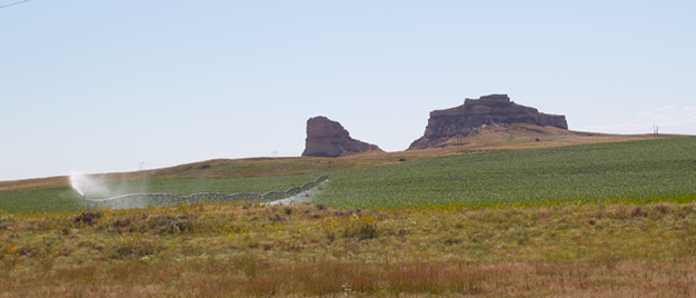
A bit later came Chimney Rock, visible from 15 miles away:
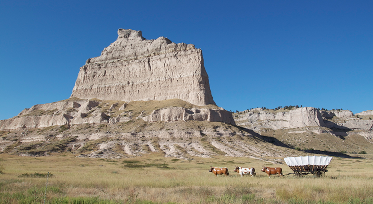
And finally the largest and most impressive formation, Scott’s Bluff.
I took the windy road up to the top of Scott’s Bluff, which gave a tremendous view of the flat land around me, and the town of Scottsbluff below. Then I headed towards the Wyoming border. I’d covered in two hours what took Oregon Trail pioneers ten days, crossing rivers using concrete bridges instead of turning my car into a raft, not ONCE catching smallpox. Again, poor substitute for the real thing.
The sun was setting. I was tired and cranky, grumbling at the quaint little towns as I slowed to pass through them. I had two final stops to make before my route turned away from the Oregon Trail for good, and the sun was setting quickly.
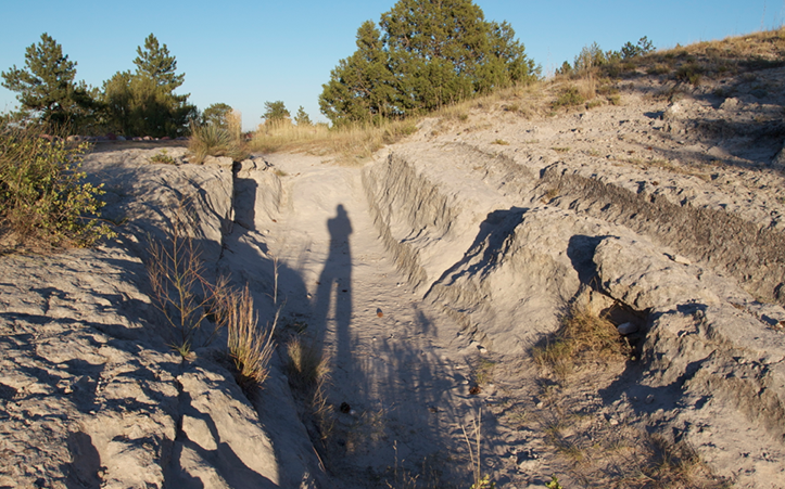
At 7:30 I passed into Guernsey, Wyoming, and took the marked turn to the Guernsey Ruts. 40 days after they left Missouri, the weary pioneers rolled their wagons up the sandstone bluff south of the river here, then back down the other side. 250,000 human beings crossed this exact spot. And their wagon wheels, over 25 years, carved a canyon in the side of the hill.
It was an incredible physical reminder of the efforts people went to, in those days, to seek a new and better life. But there was one more reminder to see, and the sun was almost gone.
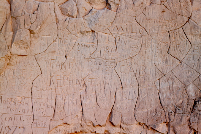
Like a bat out of hell I drove a winding gravel road two miles up the river, dust kicking up behind me in the fading sunlight. I turned at the sign for Inscription Rock. Two extremely tame rabbits chewed their grass and regarded me curiously as I jumped out of the car, grabbed my camera, and jogged up to the cliff face.
It was here, starting as early as 1840, that the emigrants carved their names as they walked past. As the final stop on my tour, it was like seeing a literal signature on the Oregon Trail itself. In the few moments of sunlight remaining, I took pictures and tried to read as many of the names as I could make out; one, dated 1923, was named “Kevin L.” Close enough.
The sun was finally gone. In the dark, I turned my car north on I-25, away from the trail. I was glad I’d seen it.


Thanks for sharing, Kevin. And I’m glad you haven’t contracted smallpox. Yet. 😉
Hi Kevin, I hope to read more about your adventures. I really like this kind of exploration, and your photos and write up make me really want to go explore that part of the oregon trail.
Thanks!!